


Geoscientific Project
Geoscientific Project
Aims of the Geoscientific Project
The Geoscientific Project is set out to develop and train practical skills of both professional and general character. It enables the students to realize own conceptions, to acquire additional fields of competence and to establish contacts, which may improve their chances on the job market. The project fosters personal initiative and „learning by doing“, but equally represents a supervised, output-oriented practical project, which is to be documented by a written report and explained by a colloquium talk.
The project may be devised and realized in a fully self-contained approach or be integrated as contribution to an ongoing research or commercial project. The responsibility to initiate one’s project and find a suitable advisor is entirely on the side of the students. Both individual and team projects are possible; in case of field projects, the latter often have logistic and operational advantages. For team projects, a well-defined task-sharing should be established from the beginning. Contribution and performance of every team partner must be demonstrated and evaluated separately at the end.
The geoscientific project should not anticipate the mostly lab-oriented and analytical master thesis project. Not the scientific progress is in the foreground, but a conclusive idea, practical value, wise planning, a telling and interesting documentation of results and - last not least - the broadening of the own horizon.
Project Topics
When choosing a project concept, the scope of possible orientations is very broad.
Every proposed project idea is individually examined and will be approved, if it fulfills
the stated intentions, appears realistic and adequate with regard to its scale and
complexity. Possible projects are for example:
- Field or mapping project at land or sea without major laboratory components using field methods of geology, geophysics or mineralogy, also as contribution to a commercial or research project
- Media or school project like an extensive popular science article, an internet production, a video movie, a radio emission, an exhibit or a scholar teaching unit on a geoscientific topic
- Technical project for development, improvement and testing of practical geoscientific gear or instrumentation
- External project at a company, organization or authority, which is geoscientifically demanding and has presentable aims, operations and results
- International project comprising geoscientific activities abroad and cooperations with foreign partners
Competences
- Design, realize, document and present a professional geoscientific project following own conceptions or agreements with project partners
- Establish contacts and cooperations with companies, authorities, organisations or research institutions in Germany or abroad
- Develop new competences in scientific methods, project design and planning, decision-making, communication and management, that are beneficial for later career
- Gain insights into the project scenarios of fellow students and learn from their experiences by participating in several of the five yearly project report colloquia
Time frame
For reasons of comparability and recognition, the duration of each project exercise should not greatly exceed or fall below 10-12 weeks (450 hours / 15 CP). The practical part of the project exercise ist mostly performed between September and November, but can also be realized earlier or later if convenient.
The project period typically commences with a 1-2 weeks’ phase of planning, preparation and literature research, followed by 4-6 weeks of practical field or project work (reduced to 2-4 weeks on ship). Data processing and documentation in a written project report should typically last another 2-4 week.
The project is finalized with an oral presentation in a report colloquium in the presence of all fellow students and project advisors and evaluated by a jury.
Evaluation
The project concept, realization and analysis will be evaluated as well as the quality of the written text, graphics and presentation of the report (50%) and the oral presentation (50%). Further information on supervision, application, costs, examination and evaluation are to be found in the guidelines in the download column.
Combined examination consisting of a colloquium (50%) and a project report (50%)
Further Information
Information event on the requirements of the project module and individual consultations regarding project ideas, written application and approval of the project in the examination office takes place at the beginning of each semester. Detailed information on the date will be announced via StudIP.
Literature
Guidelines on the realization of the „Geoscientific Project“ for the master programs „Applied Geosciences“ and „Marine Geosciences“, Faculty of Geosciences, University of Bremen Basic data
VAK-Number:
05-MAG-GP-1
Module Type
Mandatory
15 CP / 10-12 weeks (4 SWS)
Exam Type
combination exam
50 % presentation 50 % project exercise report
Registration
sent by email to khuhn@uni-bremen.de and registration in Stud.IP
Contact
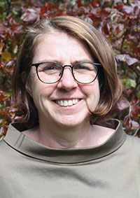
Modul Coordinator
Prof. Dr. Katrin Huhn-Frehers
MARUM2 3040
Modul Coordinator
Prof. Dr. Katrin Huhn-Frehers
MARUM2 3040